Columbia River Estuary Study Taskforce
  • About
    • Our Approach
    • The CREST Story >
      • Background | CREST
      • Origins of CREST
      • CREST's Current Vision
    • Team >
      • Objectives
      • Denise Lofman
      • Tom Josephson
      • Jason Smith
      • Tracy Hruska
      • April Silva
      • Narayan Elasmar
      • Paula Gerttula
      • Robert Henicksman
      • Mandy Flaitz
      • Garrett Phillips
    • In The News
  • Services
    • Restoration Planning & Implementation
    • Ecosystem Research & Monitoring
    • Environmental Planning & GIS Mapping
    • Wetland Delineations & Assessments
    • Resource Library >
      • Available Documents
  • CREST Projects
    • Reach A, Coastal Lowlands Entrance >
      • Colewort Creek Wetland Enhancement
      • Fee-Simon Wetland Enhancement
      • Ft Columbia Tidal Reconnection
      • Hungry Harbor
      • Megler Creek
      • Otter Point Estuarine Restoration
      • West Sand Island
    • Reach B, Coastal Uplands Salinity Gradient >
      • Bear, Mary's, and Ferris Creeks
      • Gnat Creek Wetland Enhancement
      • Harlow Creek
      • Karlson Island Wetland Enhancement
      • South Tongue Point Wetland
    • Reach D, Western Cascades Tributary Confluences >
      • Dibblee Point Wetland Restoration
    • Reach E, Tidal Flood Plain Basin Constriction
    • Reach F, Middle Tidal Flood Plain Basin >
      • 3-Finger Jack Restoration
      • Bridge at Buckmire Slough
      • Crane Wetlands Restoration
      • Deep/Widgeon Restoration
      • Domeyer Wetlands Restoration
      • Flights End Restoration
      • McCarthy Creek Restoration
      • Millionaire Lake Restoration
      • Ruby Lake Restoration
      • South Bachelor Island Restoration
      • South Slough Restoration
      • Sturgeon Lake/Dairy Creek Restoration
      • Willow Bar Restoration
    • Reach G, Upper Tidal Flood Plain Basin >
      • Government Island Restoration
  • Partnerships
    • CREST Members >
      • Oregon Members
      • Washington Members
    • CREST Partners >
      • Bonneville Power Administration
      • Columbia Land Trust
      • Lewis & Clark National Historic Park
      • Lower Columbia Estuary Partnership
      • National Oceanic & Atmospheric Administration
      • North Coast Land Conservancy
      • North Coast Watershed Association
      • OR Department of State Lands
      • OR Department of Fish & Wildlife
      • OR Watershed Enhancement Board
      • PC Trask & Associates
      • US Army Corp of Engineers
      • USDA Natural Resources Conservation Service
      • US Fish & Wildlife Service
      • WA Dept of Fish & Wildlife
      • WA Dept of Natural Resources
      • WA Dept of Transportation
      • West Multnomah Soil & Water Conservation District
  • Contact
    • RFP's

Sturgeon Lake/Dairy Creek Restoration

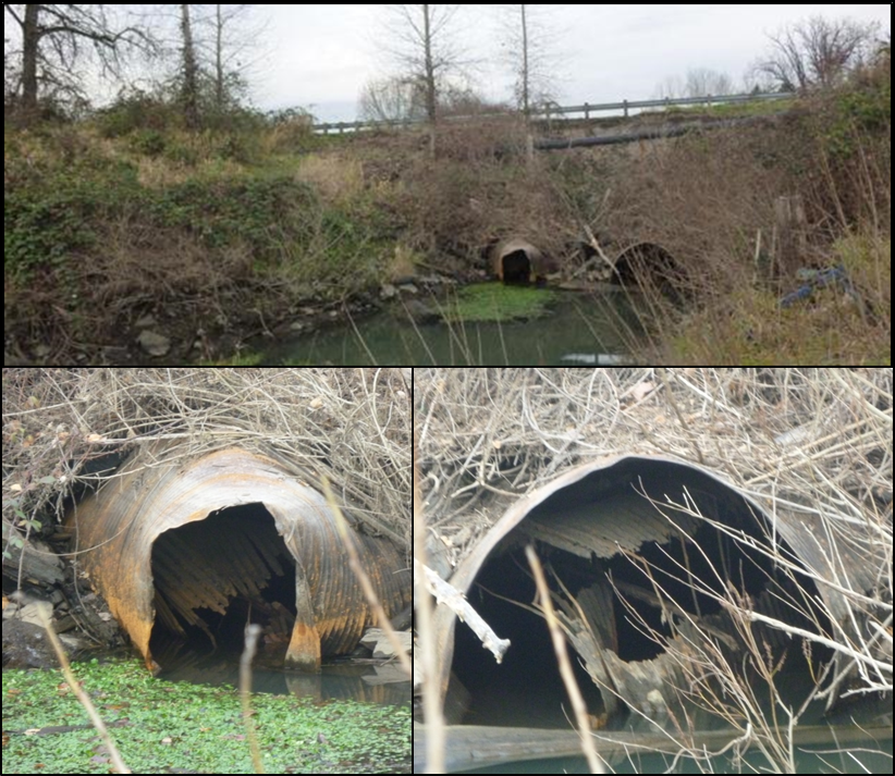
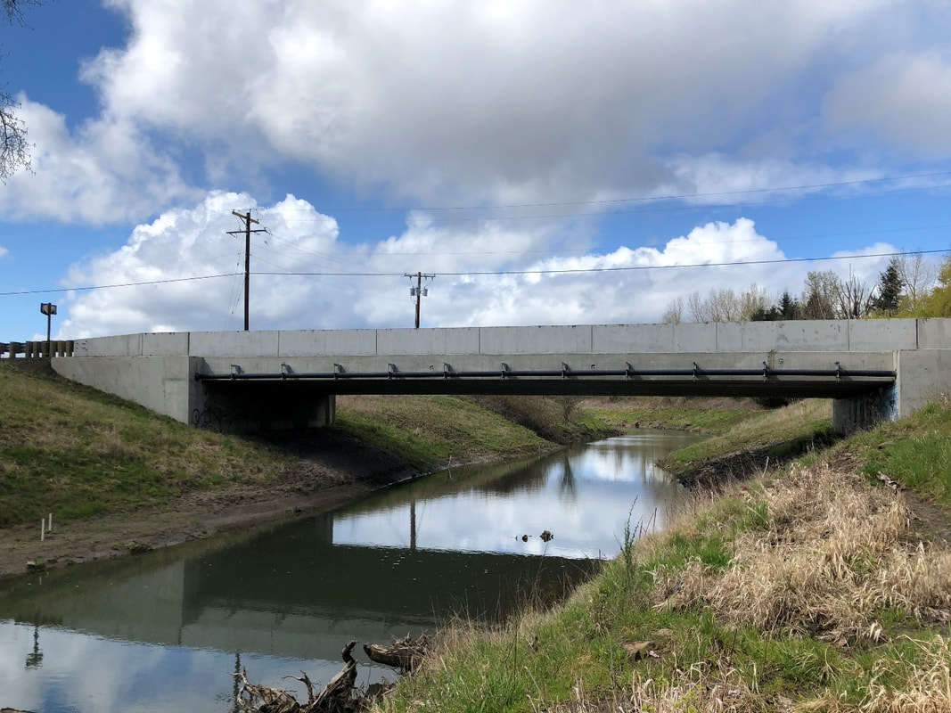
Sturgeon Lake is the largest body of water on Sauvie Island and serves as an important rearing area for juvenile salmonids and migratory waterfowl. Due to collapsed culverts and sedimentation in Dairy Creek, prior to 2018 the Lake had only one ingress/egress point (Gilbert River). The Sturgeon Lake Restoration project reconnected a second channel to this extensive 4,100 acre lake and wetland complex by removing failing culverts and creating a permanent tidal channel between the Columbia River and the lake.
 
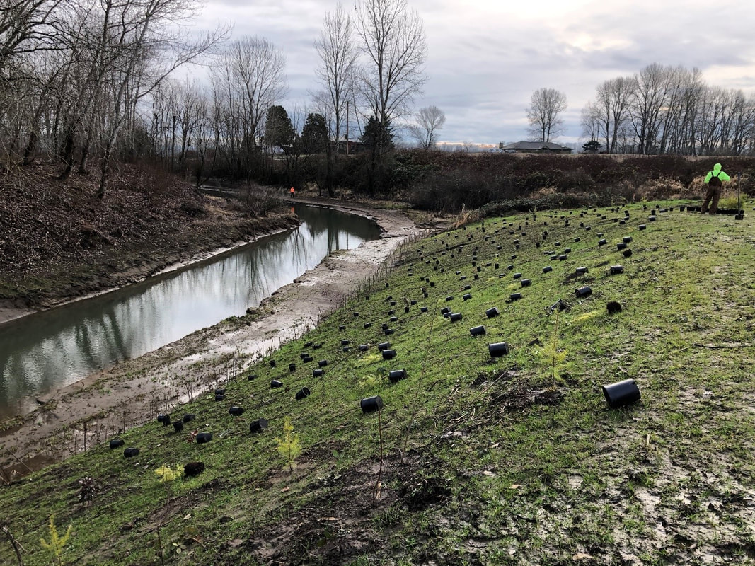
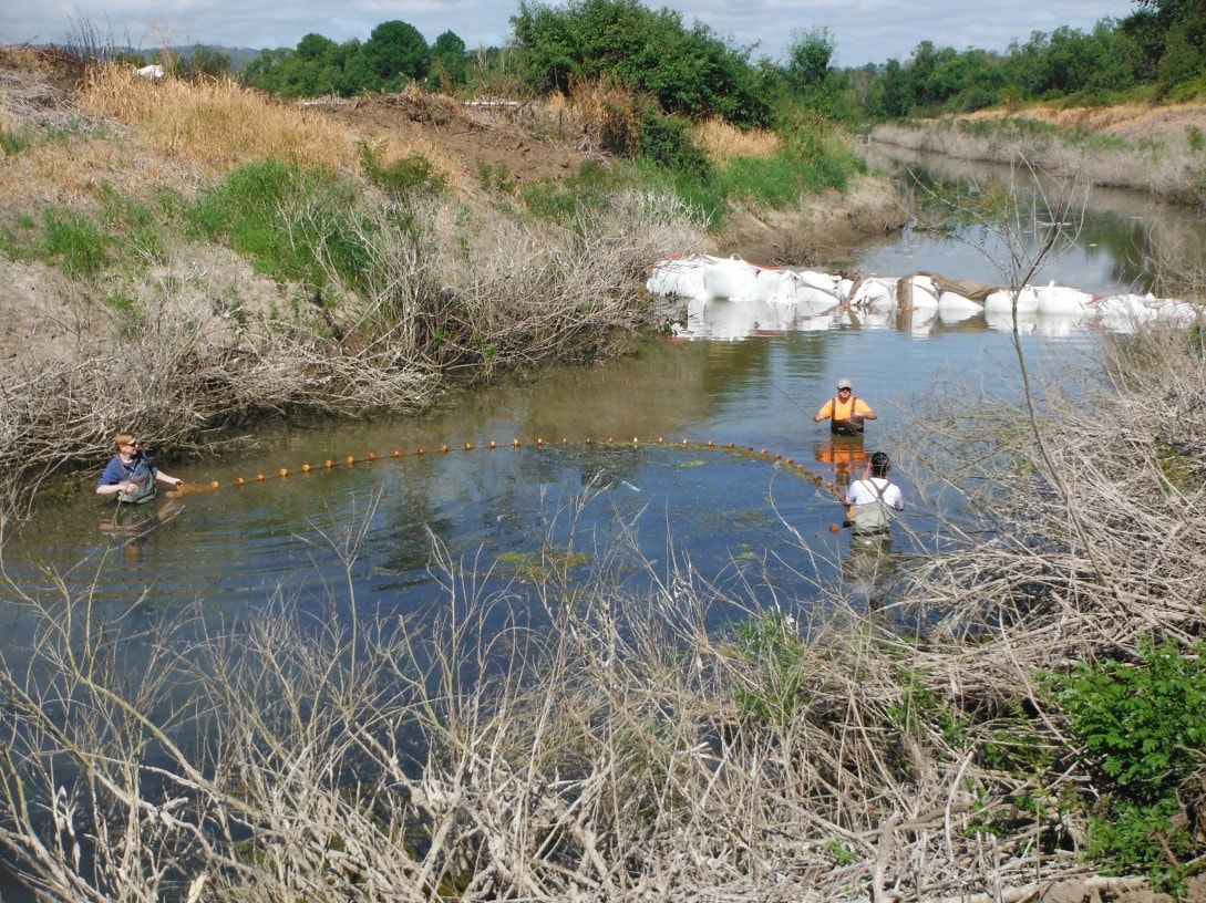
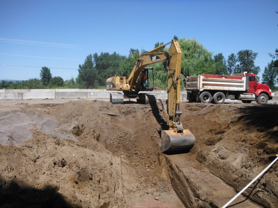
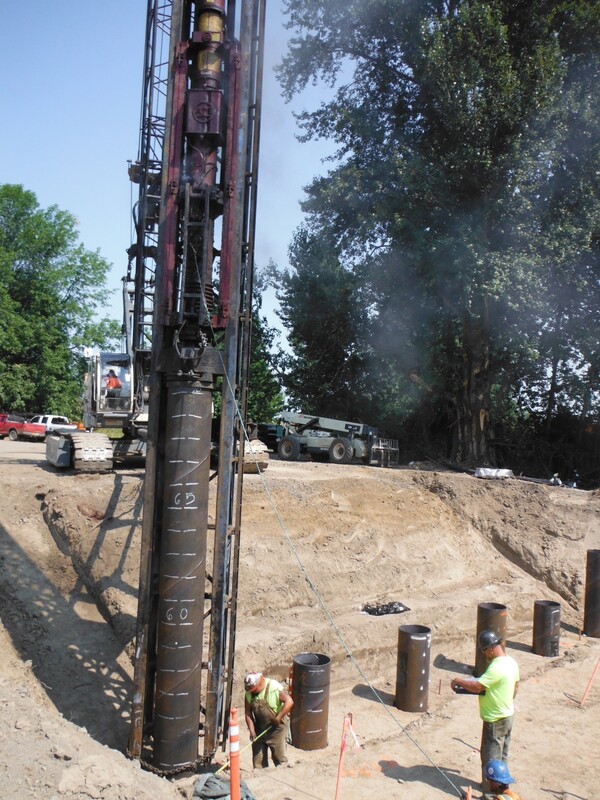
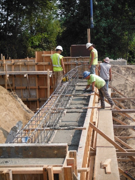
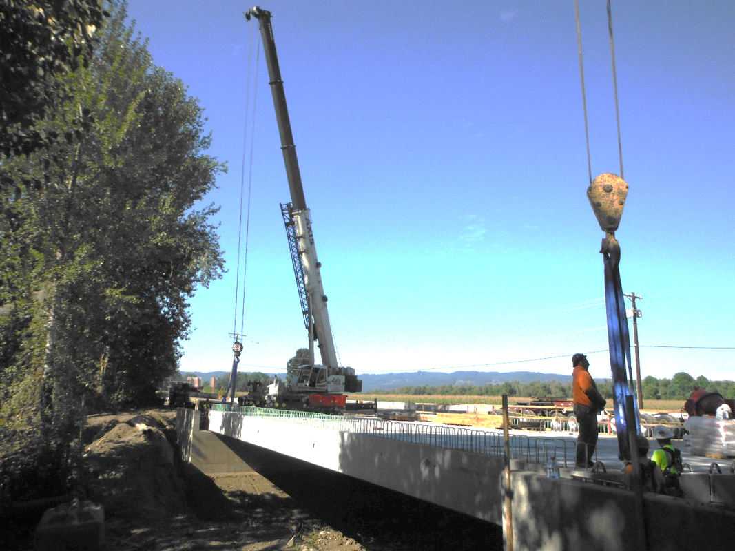
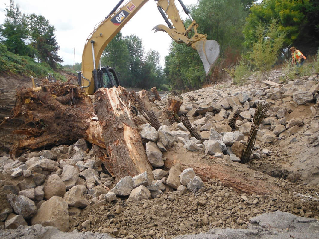
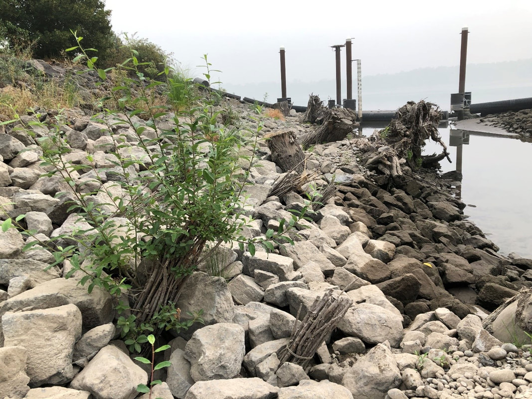
In the summer of 2018, CREST and project partners replaced collapsed culverts in Dairy Creek with a channel-spanning 96 foot long roadway bridge. A new low-flow tidal channel was excavated to provide year-round hydraulic flows and fish access and two full time tidal openings. The project created ½ mile of new tidal channel, removed 22,000 cubic yards of material from the slough, replaced two failing culverts with a channel-spanning 96 foot long bridge, replanted over 15,000 trees and shrubs, and installed several in-stream habitat features.

Project partners:
Bonneville Power Administration
Oregon Dept of Fish and Wildlife
US Army Corps of Engineers
West Multnomah Soil and Water Conservation District

Related services: 
Restoration Planning & Implementation
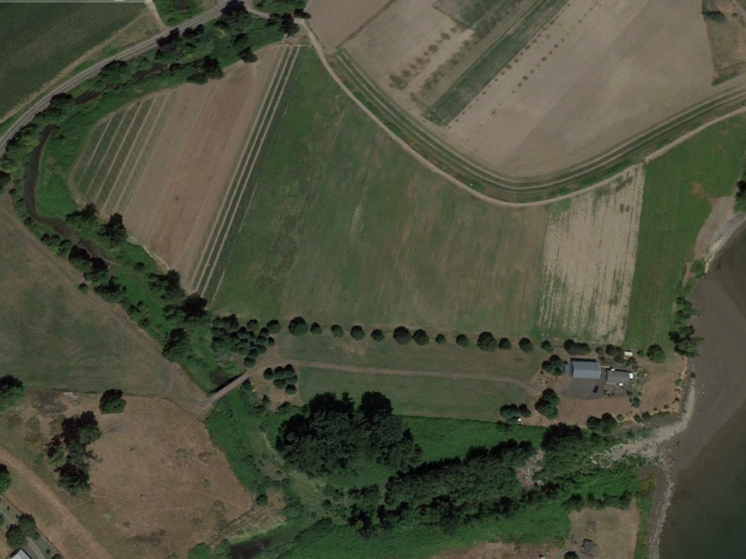
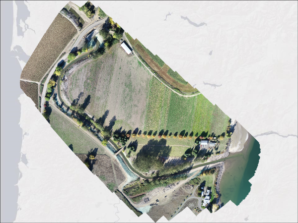
Location of Project

Pre-project culverts in Dairy Creek
Pre-project stream channel restricted with invasive reed canary grass and sediment
Excavation of new tidal channel
Replanting of new channel
CREST biologists and partners at WMSWCD conducting fish salvage prior to in-water work
Juvenile Chinook salmon captured and released outside of the work area
Bridge replacement
Completed bridge
Live willow stakes growing within the scour protection rock
Pre-project channel filled with sediment
Aerial image of completed stream channel work

CREST's mission is to provide locally-based, high quality environmental planning, habitat restoration, and research services to the Columbia-Pacific Region."

Picture
© Copyright 2020 CREST - Designed by Ham It Up Strategies 
Columbia River Estuary Study Taskforce
​818 Commercial Street, Suite 203
Astoria, Oregon  97103
503-325-0435
Fax 503-325-0459
Site Directory
  • About
    • Our Approach
    • The CREST Story >
      • Background | CREST
      • Origins of CREST
      • CREST's Current Vision
    • Team >
      • Objectives
      • Denise Lofman
      • Tom Josephson
      • Jason Smith
      • Tracy Hruska
      • April Silva
      • Narayan Elasmar
      • Paula Gerttula
      • Robert Henicksman
      • Mandy Flaitz
      • Garrett Phillips
    • In The News
  • Services
    • Restoration Planning & Implementation
    • Ecosystem Research & Monitoring
    • Environmental Planning & GIS Mapping
    • Wetland Delineations & Assessments
    • Resource Library >
      • Available Documents
  • CREST Projects
    • Reach A, Coastal Lowlands Entrance >
      • Colewort Creek Wetland Enhancement
      • Fee-Simon Wetland Enhancement
      • Ft Columbia Tidal Reconnection
      • Hungry Harbor
      • Megler Creek
      • Otter Point Estuarine Restoration
      • West Sand Island
    • Reach B, Coastal Uplands Salinity Gradient >
      • Bear, Mary's, and Ferris Creeks
      • Gnat Creek Wetland Enhancement
      • Harlow Creek
      • Karlson Island Wetland Enhancement
      • South Tongue Point Wetland
    • Reach D, Western Cascades Tributary Confluences >
      • Dibblee Point Wetland Restoration
    • Reach E, Tidal Flood Plain Basin Constriction
    • Reach F, Middle Tidal Flood Plain Basin >
      • 3-Finger Jack Restoration
      • Bridge at Buckmire Slough
      • Crane Wetlands Restoration
      • Deep/Widgeon Restoration
      • Domeyer Wetlands Restoration
      • Flights End Restoration
      • McCarthy Creek Restoration
      • Millionaire Lake Restoration
      • Ruby Lake Restoration
      • South Bachelor Island Restoration
      • South Slough Restoration
      • Sturgeon Lake/Dairy Creek Restoration
      • Willow Bar Restoration
    • Reach G, Upper Tidal Flood Plain Basin >
      • Government Island Restoration
  • Partnerships
    • CREST Members >
      • Oregon Members
      • Washington Members
    • CREST Partners >
      • Bonneville Power Administration
      • Columbia Land Trust
      • Lewis & Clark National Historic Park
      • Lower Columbia Estuary Partnership
      • National Oceanic & Atmospheric Administration
      • North Coast Land Conservancy
      • North Coast Watershed Association
      • OR Department of State Lands
      • OR Department of Fish & Wildlife
      • OR Watershed Enhancement Board
      • PC Trask & Associates
      • US Army Corp of Engineers
      • USDA Natural Resources Conservation Service
      • US Fish & Wildlife Service
      • WA Dept of Fish & Wildlife
      • WA Dept of Natural Resources
      • WA Dept of Transportation
      • West Multnomah Soil & Water Conservation District
  • Contact
    • RFP's