Columbia River Estuary Study Taskforce
  • About
    • Our Approach
    • The CREST Story >
      • Background | CREST
      • Origins of CREST
      • CREST's Current Vision
    • Team >
      • Objectives
      • Denise Lofman
      • Tom Josephson
      • Jason Smith
      • Tracy Hruska
      • April Silva
      • Narayan Elasmar
      • Paula Gerttula
      • Robert Henicksman
      • Mandy Flaitz
      • Garrett Phillips
    • In The News
  • Services
    • Restoration Planning & Implementation
    • Ecosystem Research & Monitoring
    • Environmental Planning & GIS Mapping
    • Wetland Delineations & Assessments
    • Resource Library >
      • Available Documents
  • CREST Projects
    • Reach A, Coastal Lowlands Entrance >
      • Colewort Creek Wetland Enhancement
      • Fee-Simon Wetland Enhancement
      • Ft Columbia Tidal Reconnection
      • Hungry Harbor
      • Megler Creek
      • Otter Point Estuarine Restoration
      • West Sand Island
    • Reach B, Coastal Uplands Salinity Gradient >
      • Bear, Mary's, and Ferris Creeks
      • Gnat Creek Wetland Enhancement
      • Harlow Creek
      • Karlson Island Wetland Enhancement
      • South Tongue Point Wetland
    • Reach D, Western Cascades Tributary Confluences >
      • Dibblee Point Wetland Restoration
    • Reach E, Tidal Flood Plain Basin Constriction
    • Reach F, Middle Tidal Flood Plain Basin >
      • 3-Finger Jack Restoration
      • Bridge at Buckmire Slough
      • Crane Wetlands Restoration
      • Deep/Widgeon Restoration
      • Domeyer Wetlands Restoration
      • Flights End Restoration
      • McCarthy Creek Restoration
      • Millionaire Lake Restoration
      • Ruby Lake Restoration
      • South Bachelor Island Restoration
      • South Slough Restoration
      • Sturgeon Lake/Dairy Creek Restoration
      • Willow Bar Restoration
    • Reach G, Upper Tidal Flood Plain Basin >
      • Government Island Restoration
  • Partnerships
    • CREST Members >
      • Oregon Members
      • Washington Members
    • CREST Partners >
      • Bonneville Power Administration
      • Columbia Land Trust
      • Lewis & Clark National Historic Park
      • Lower Columbia Estuary Partnership
      • National Oceanic & Atmospheric Administration
      • North Coast Land Conservancy
      • North Coast Watershed Association
      • OR Department of State Lands
      • OR Department of Fish & Wildlife
      • OR Watershed Enhancement Board
      • PC Trask & Associates
      • US Army Corp of Engineers
      • USDA Natural Resources Conservation Service
      • US Fish & Wildlife Service
      • WA Dept of Fish & Wildlife
      • WA Dept of Natural Resources
      • WA Dept of Transportation
      • West Multnomah Soil & Water Conservation District
  • Contact
    • RFP's

Origins of CREST

Where did CREST come from?

Picture
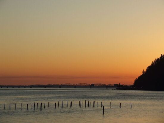
Columbia River at Sunset
In response to growing conflicts over use and development of estuarine areas and dwindling natural resources, CREST- whose original acronym was defined as "Columbia River Estuary Study Taskforce"- was established in 1974 to gather scientific background material and develop an estuary-wide management plan. CREST was initiated as a non-regulatory Council of Governments by local governments in both Oregon and Washington. 
This resulted in the Columbia River Estuary Inventory of Physical, Biological, and Cultural Characteristics (1977) and the Columbia River Estuary Regional Management Plan (1979). The management plan was later adopted into local comprehensive plans and shoreline master programs. Based on data needs identified during the development of the Inventory, Congress authorized and funded the Columbia River Estuary Data Development Program (CREDDP), which provided a wealth of information that is still used by government and academic entities in resource planning.
After the completion of CREDDP in the mid-1980’s, CREST began to provide its member jurisdictions with planning services related to: regulatory permitting, zoning ordinances, comprehensive plan and shoreline master plan amendments, estuary impact analyses, and issues related to dredging, wetlands and water quality. In the late 1990s, CREST also began to provide technical and administrative assistance to the watershed councils of Clatsop County. This, along with growing regional awareness of the ecological importance of the estuary to salmon runs, has led CREST to an emphasis on habitat restoration. Finally, to demonstrate the effectiveness of CREST-sponsored habitat restoration projects, biologists were hired to perform seasonal research and monitoring.

CREST's mission is to provide locally-based, high quality environmental planning, habitat restoration, and research services to the Columbia-Pacific Region."

Picture
© Copyright 2020 CREST - Designed by Ham It Up Strategies 
Columbia River Estuary Study Taskforce
​818 Commercial Street, Suite 203
Astoria, Oregon  97103
503-325-0435
Fax 503-325-0459
Site Directory
  • About
    • Our Approach
    • The CREST Story >
      • Background | CREST
      • Origins of CREST
      • CREST's Current Vision
    • Team >
      • Objectives
      • Denise Lofman
      • Tom Josephson
      • Jason Smith
      • Tracy Hruska
      • April Silva
      • Narayan Elasmar
      • Paula Gerttula
      • Robert Henicksman
      • Mandy Flaitz
      • Garrett Phillips
    • In The News
  • Services
    • Restoration Planning & Implementation
    • Ecosystem Research & Monitoring
    • Environmental Planning & GIS Mapping
    • Wetland Delineations & Assessments
    • Resource Library >
      • Available Documents
  • CREST Projects
    • Reach A, Coastal Lowlands Entrance >
      • Colewort Creek Wetland Enhancement
      • Fee-Simon Wetland Enhancement
      • Ft Columbia Tidal Reconnection
      • Hungry Harbor
      • Megler Creek
      • Otter Point Estuarine Restoration
      • West Sand Island
    • Reach B, Coastal Uplands Salinity Gradient >
      • Bear, Mary's, and Ferris Creeks
      • Gnat Creek Wetland Enhancement
      • Harlow Creek
      • Karlson Island Wetland Enhancement
      • South Tongue Point Wetland
    • Reach D, Western Cascades Tributary Confluences >
      • Dibblee Point Wetland Restoration
    • Reach E, Tidal Flood Plain Basin Constriction
    • Reach F, Middle Tidal Flood Plain Basin >
      • 3-Finger Jack Restoration
      • Bridge at Buckmire Slough
      • Crane Wetlands Restoration
      • Deep/Widgeon Restoration
      • Domeyer Wetlands Restoration
      • Flights End Restoration
      • McCarthy Creek Restoration
      • Millionaire Lake Restoration
      • Ruby Lake Restoration
      • South Bachelor Island Restoration
      • South Slough Restoration
      • Sturgeon Lake/Dairy Creek Restoration
      • Willow Bar Restoration
    • Reach G, Upper Tidal Flood Plain Basin >
      • Government Island Restoration
  • Partnerships
    • CREST Members >
      • Oregon Members
      • Washington Members
    • CREST Partners >
      • Bonneville Power Administration
      • Columbia Land Trust
      • Lewis & Clark National Historic Park
      • Lower Columbia Estuary Partnership
      • National Oceanic & Atmospheric Administration
      • North Coast Land Conservancy
      • North Coast Watershed Association
      • OR Department of State Lands
      • OR Department of Fish & Wildlife
      • OR Watershed Enhancement Board
      • PC Trask & Associates
      • US Army Corp of Engineers
      • USDA Natural Resources Conservation Service
      • US Fish & Wildlife Service
      • WA Dept of Fish & Wildlife
      • WA Dept of Natural Resources
      • WA Dept of Transportation
      • West Multnomah Soil & Water Conservation District
  • Contact
    • RFP's