Columbia River Estuary Study Taskforce
  • About
    • Our Approach
    • The CREST Story >
      • Background | CREST
      • Origins of CREST
      • CREST's Current Vision
    • Team >
      • Objectives
      • Denise Lofman
      • Jason Smith
      • Jess Hoch
      • Jay Horita
      • Zach Bigelow
      • Kyle Purdy
      • Narayan Elasmar
      • Garrett Phillips
      • Robert Henicksman
      • Mandy Flaitz
      • Becky Onsgaard
    • In The News
  • Services
    • Restoration Planning & Implementation
    • Ecosystem Research & Monitoring
    • Environmental Planning & GIS Mapping
    • Wetland Delineations & Assessments
    • Resource Library >
      • Available Documents
  • CREST Projects
    • Reach A, Coastal Lowlands Entrance >
      • Colewort Creek Wetland Enhancement
      • Fee-Simon Wetland Enhancement
      • Ft Columbia Tidal Reconnection
      • Hungry Harbor
      • Megler Creek
      • Otter Point Estuarine Restoration
      • West Sand Island
    • Reach B, Coastal Uplands Salinity Gradient >
      • Bear, Mary's, and Ferris Creeks
      • Gnat Creek Wetland Enhancement
      • Harlow Creek
      • Karlson Island Wetland Enhancement
      • South Tongue Point Wetland
    • Reach D, Western Cascades Tributary Confluences >
      • Dibblee Point Wetland Restoration
    • Reach E, Tidal Flood Plain Basin Constriction
    • Reach F, Middle Tidal Flood Plain Basin >
      • 3-Finger Jack Restoration
      • Bridge at Buckmire Slough
      • Crane Wetlands Restoration
      • Deep/Widgeon Restoration
      • Domeyer Wetlands Restoration
      • Flights End Restoration
      • McCarthy Creek Restoration
      • Millionaire Lake Restoration
      • Ruby Lake Restoration
      • South Bachelor Island Restoration
      • South Slough Restoration
      • Sturgeon Lake/Dairy Creek Restoration
      • Willow Bar Restoration
    • Reach G, Upper Tidal Flood Plain Basin >
      • Government Island Restoration
  • Partnerships
    • CREST Members >
      • Oregon Members
      • Washington Members
    • CREST Partners >
      • Bonneville Power Administration
      • Columbia Land Trust
      • Lewis & Clark National Historic Park
      • Lower Columbia Estuary Partnership
      • National Oceanic & Atmospheric Administration
      • North Coast Land Conservancy
      • North Coast Watershed Association
      • OR Department of State Lands
      • OR Department of Fish & Wildlife
      • OR Watershed Enhancement Board
      • PC Trask & Associates
      • US Army Corp of Engineers
      • USDA Natural Resources Conservation Service
      • US Fish & Wildlife Service
      • WA Dept of Fish & Wildlife
      • WA Dept of Natural Resources
      • WA Dept of Transportation
      • West Multnomah Soil & Water Conservation District
  • Contact
    • RFP's
    • Meetings
    • Employment

Karlson Island Wetland Enhancement

Location: U.S. Fish and Wildlife Lewis and Clark Wildlife Refuge, Knappa, Oregon

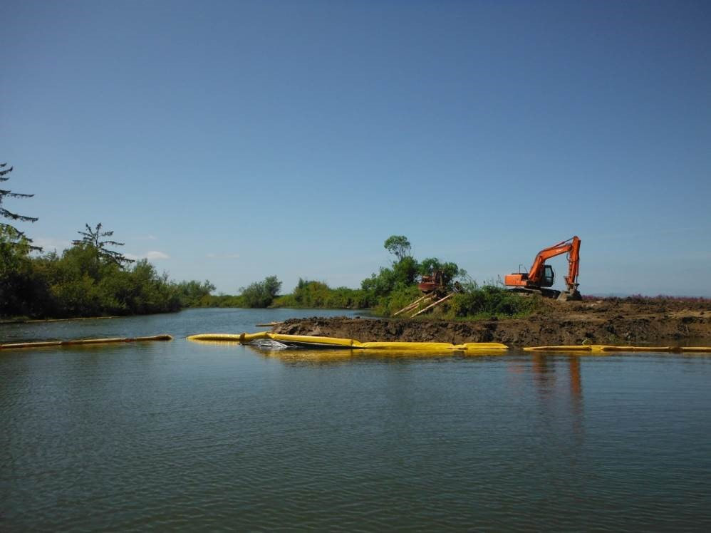
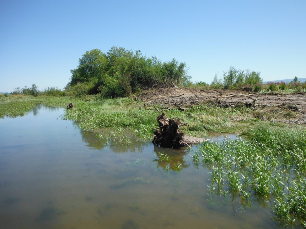
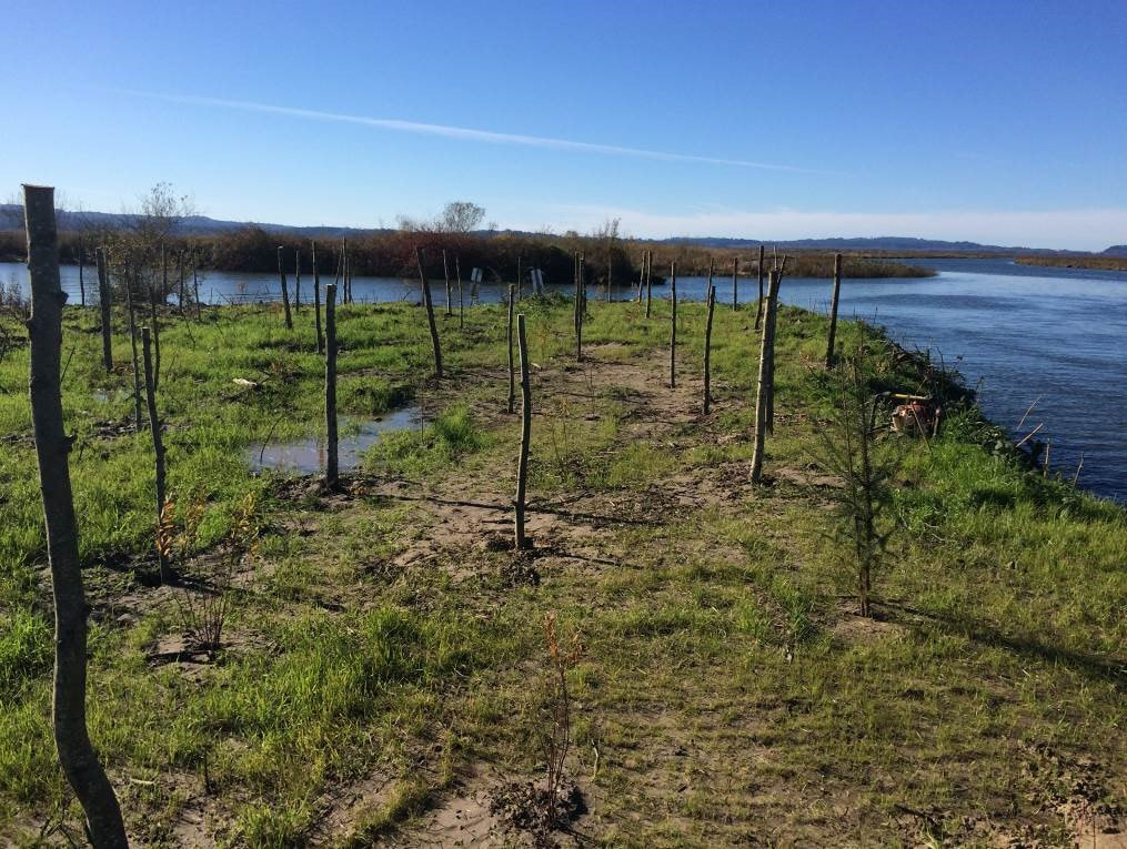
In summer 2014, the restoration project was completed and restored hydrology and fish access to the 320 acres of tidal marsh habitat. Over 2,050 feet of levee was removed, 760 linear feet of channel was created, native vegetation was planted over 4 acres of disturbed areas, 38 pieces of large woody debris was added to the slough network, 2 culverts and tidegates were removed, and 9 acres of habitat was treated for invasive species.

Project partners: 
Bonneville Power Administration
US Fish and Wildlife Service

Related services: 
Restoration Planning & Implementation

Location of Project

Picture
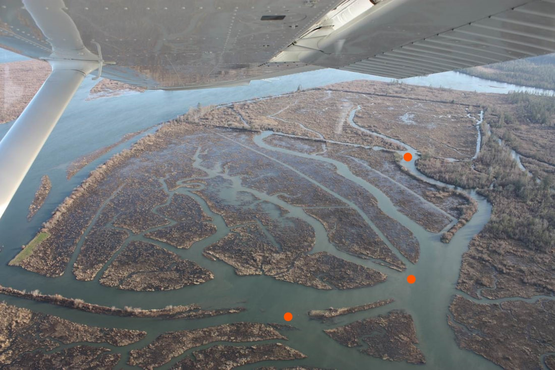
Karlson Island after restoration (notice 3 of 9 breach locations). Photo taken in January 2015 by Tom Josephson, courtesy of LightHawk and Jane Rosevelt. Orange dots denote New Channel Connections.
Removal of portions of old levee
Large wood installed at breach location
Replanted area with cottonwood poles, sitka spruce, and native grass
Channel
Marsh Plain
Using acoustic Doppler to measure CFS
CREST's mission is to provide locally-based, high quality environmental planning, habitat restoration, and research services to the Columbia-Pacific Region."

Picture
© Copyright 2020 CREST - Designed by Ham It Up Strategies 
Columbia River Estuary Study Taskforce
​818 Commercial Street, Suite 203
Astoria, Oregon  97103
503-325-0435
Fax 503-325-0459
Site Directory
  • About
    • Our Approach
    • The CREST Story >
      • Background | CREST
      • Origins of CREST
      • CREST's Current Vision
    • Team >
      • Objectives
      • Denise Lofman
      • Jason Smith
      • Jess Hoch
      • Jay Horita
      • Zach Bigelow
      • Kyle Purdy
      • Narayan Elasmar
      • Garrett Phillips
      • Robert Henicksman
      • Mandy Flaitz
      • Becky Onsgaard
    • In The News
  • Services
    • Restoration Planning & Implementation
    • Ecosystem Research & Monitoring
    • Environmental Planning & GIS Mapping
    • Wetland Delineations & Assessments
    • Resource Library >
      • Available Documents
  • CREST Projects
    • Reach A, Coastal Lowlands Entrance >
      • Colewort Creek Wetland Enhancement
      • Fee-Simon Wetland Enhancement
      • Ft Columbia Tidal Reconnection
      • Hungry Harbor
      • Megler Creek
      • Otter Point Estuarine Restoration
      • West Sand Island
    • Reach B, Coastal Uplands Salinity Gradient >
      • Bear, Mary's, and Ferris Creeks
      • Gnat Creek Wetland Enhancement
      • Harlow Creek
      • Karlson Island Wetland Enhancement
      • South Tongue Point Wetland
    • Reach D, Western Cascades Tributary Confluences >
      • Dibblee Point Wetland Restoration
    • Reach E, Tidal Flood Plain Basin Constriction
    • Reach F, Middle Tidal Flood Plain Basin >
      • 3-Finger Jack Restoration
      • Bridge at Buckmire Slough
      • Crane Wetlands Restoration
      • Deep/Widgeon Restoration
      • Domeyer Wetlands Restoration
      • Flights End Restoration
      • McCarthy Creek Restoration
      • Millionaire Lake Restoration
      • Ruby Lake Restoration
      • South Bachelor Island Restoration
      • South Slough Restoration
      • Sturgeon Lake/Dairy Creek Restoration
      • Willow Bar Restoration
    • Reach G, Upper Tidal Flood Plain Basin >
      • Government Island Restoration
  • Partnerships
    • CREST Members >
      • Oregon Members
      • Washington Members
    • CREST Partners >
      • Bonneville Power Administration
      • Columbia Land Trust
      • Lewis & Clark National Historic Park
      • Lower Columbia Estuary Partnership
      • National Oceanic & Atmospheric Administration
      • North Coast Land Conservancy
      • North Coast Watershed Association
      • OR Department of State Lands
      • OR Department of Fish & Wildlife
      • OR Watershed Enhancement Board
      • PC Trask & Associates
      • US Army Corp of Engineers
      • USDA Natural Resources Conservation Service
      • US Fish & Wildlife Service
      • WA Dept of Fish & Wildlife
      • WA Dept of Natural Resources
      • WA Dept of Transportation
      • West Multnomah Soil & Water Conservation District
  • Contact
    • RFP's
    • Meetings
    • Employment